1/5


Outdoor Südtirol
1K+下载次数
224.5MB大小
3.17.8(10-09-2024)最新版本
详情评价版本信息
1/5
Outdoor Südtirol介绍
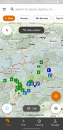
按地点搜索或激活您的位置以发现附近的活动。根据您的兴趣过滤结果并浏览地图以找到新的结果。将结果以列表形式立即查看简要说明。
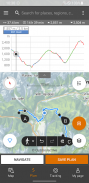
您可以获得详细的说明、技术信息、地图和 GPS 方向,您甚至可以离线保存这些内容,以便您在南蒂罗尔进行夏季和冬季户外活动。
您还可以创建自定义行程:
- 直接在应用程序的地图上计划您的行程
- 记录您的路线并添加照片和描述
- 与您的朋友分享您最喜欢的行程,以计划您在南蒂罗尔和多洛米蒂山脉的下一次户外探险
发现更多功能!
重要的:
在启用 GPS 的情况下在后台使用该应用程序可能会显着缩短电池寿命。
Outdoor Südtirol - 版本3.17.8
(10-09-2024)新特性In this version we fixed some bugs and made some performance improvements.
保证非恶意应用此应用已通过病毒、恶意软件和其他恶意攻击的安全测试,不含任何威胁。
Outdoor Südtirol - APK信息
APK版本: 3.17.8程序包: it.bz.smg名称: Outdoor Südtirol大小: 224.5 MB下载次数: 107版本: 3.17.8发布日期: 2024-09-10 11:24:18最小屏幕: SMALL支持的CPU: x86, x86-64, armeabi-v7a, arm64-v8a
程序包ID: it.bz.smgSHA1签名: B1:16:7A:C2:DA:A0:04:9F:30:81:07:E0:FD:16:12:AA:08:02:98:C3开发商 (CN): 组织 (O): top 21本地 (L): 国家/地区 (C): 州/市 (ST):
Outdoor Südtirol的最新版本
3.17.8
10/9/2024107 下载次数224.5 MB 大小
其他版本
3.14.6
14/1/2024107 下载次数224.5 MB 大小
3.9.5
13/5/2022107 下载次数62.5 MB 大小
3.7.29
24/12/2021107 下载次数63.5 MB 大小
3.1.2
20/3/2020107 下载次数50.5 MB 大小
3.1
15/3/2020107 下载次数50.5 MB 大小
3.0.11
24/2/2020107 下载次数26.5 MB 大小
3.0.4
22/11/2017107 下载次数25.5 MB 大小
3.0.1
14/1/2017107 下载次数21 MB 大小
3.0
23/12/2016107 下载次数21 MB 大小


同类应用


English


